If the weather guessers have got it right, sunscreen will be replaced by gumboots and umbrellas – again.
Canoe Beach and the pedestrian underpass have been closed to the public and the washrooms at the end of Salmon Arm’s marine wharf were within 15 centimetres of being closed Wednesday afternoon.
The brief spate of warm weather is due to be replaced tomorrow by at least another four days of rain, raising the level of the lake even more.
“It’s the season to be thinking about severe weather,” says Doug Lundquist, warning preparedness meteorologist with Environment Canada, who notes the advancing cold-air system could arrive with severe thunderstorms. “June is normally wet; I call it the monsoonal month, but this one is on steroids.”
Between June 1 and 16, the weather station at Salmon Arm Airport measured 80 millimetres of rain, considerably higher than normal rainfall, which is 63 mm for the entire month.
Heavy rain and rapid snowmelt at upper levels has swollen rivers and resulted in the BC River Forecast Centre issuing a flood warning for the Shuswap River near Enderby, and a flood watch for Shuswap Lake and tributaries, including Eagle River.
B.C.’s River Forecast Centre was expecting another surge in levels Wednesday evening or early Thursday, with additional rises of 15 cm above current levels possible. A flood watch means river levels are rising and will approach or may overflow banks, and a flood warning means river levels have exceeded the banks or will exceed them imminently.
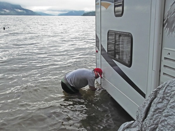
“Shuswap Lake is expected to continue rising through the next week and peak at approximately 20-year levels,” reads the advisory.
By Wednesday afternoon, the lake level was 349.17 metres – up seven cm overnight, and City of Salmon Arm public works staff were busy implementing the city’s action plan.
A log boom was set out off the end of the Salmon Arm wharf and gangplanks have all been adjusted.
Public Works manager John Rosenberg says Federated Co-op needs to be commended for responding so quickly in setting out the boom and charging only for the cost of machinery to do the job.
“They’ve been a great corporate citizen, very responsive,” he says.
Rosenberg says there has been an erosion of the land by wave action and the boat launch dock in Canoe is now four feet away from the land.
“The federal wharf is still accessible, but the parking lot is under water, and in another four inches it will be so deep you’ll need to wear your bathing suit.”
The Columbia Shuswap Regional District’s Shuswap Emergency Program (SEP) has issued a public advisory asking boaters to be courteous and conscious of the height of the wake caused by their boat.
“Boats travelling at high speed and close to shore can cause waves that increase water level as much as two feet, resulting in increased flooding and damage to affected residents,” says the release.
SEP advises the province has made sandbags and sand available at government expense to those affected by flooding.
These are available at the City of Salmon Arm public works yard, District of Sicamous public works yard, Swansea Point’s Oxford Road Beach Access Point, Sorrento Parts and Service, Gem Gravel in Celista and Falkland Fairgrounds beside Bolean Creek Bridge.
It is important to stay away from watercourses at this time. Banks will be slippery and potentially unstable due to the erosive qualities of fast-flowing water.
As well, water that looks calm on top often has deadly currents and eddies below the surface