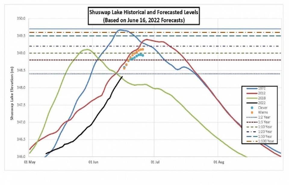
Shuswap Lake increased by 0.053 metres from Sunday to Monday.
The Columbia Shuswap Regional District is posting daily lake levels after heavy rains prompted activation of the Emergency Operations Centre.
As of 7:15 a.m. Monday the lake had reached a level of 348.581 metres, an increase of 0.053 metres.
Current levels, however, are still well off the peak seen in 1972 at a level of 349.660 metres.
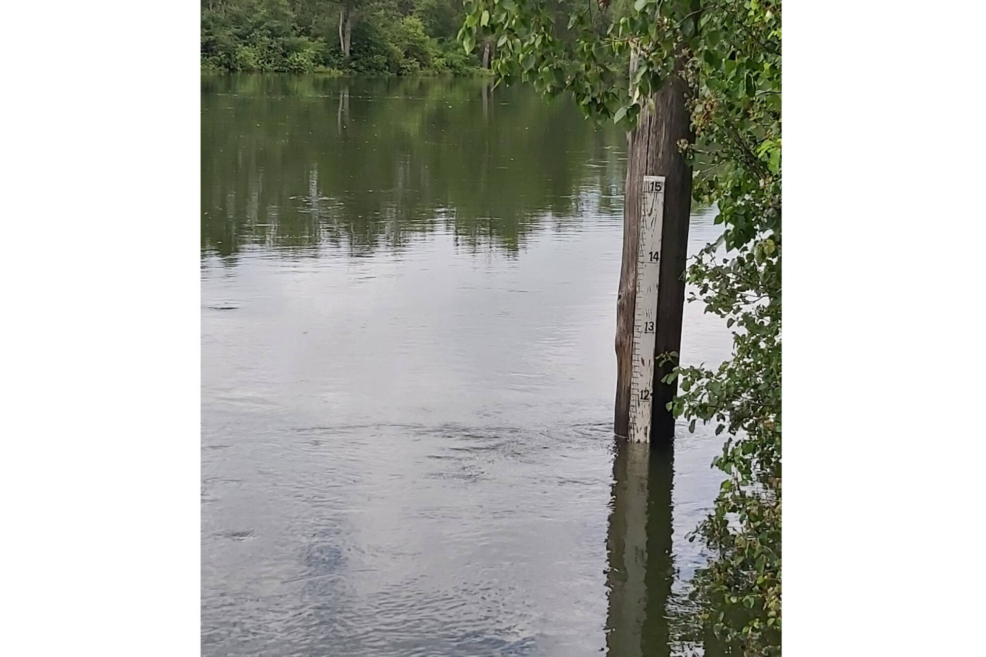
In Enderby, Shuswap River water levels have decreased three inches in three days, since Friday June 17, 2022, according to the Shuswap River Ambassadors.
In comparison, the river is the highest its been in five years:
2022- 11 feet 5 inches
2021- 6 feet 7 inches
2020- 10 feet 8 inches
2019- 4 feet 4 inches
2018- 7 feet 3 inches
“The Shuswap River is not safe to be on with human powered vessels (inflatables, kayaks, stand up paddle boards, canoes etc),” the Ambassadors urge. “Use extreme caution when near the river banks especially with children and weak swimmers.”
Closures remain in effect for Riverdale Drive, Kildonan Boat Launch and Tuey Park.
Sand and sandbags are available for free at the Public Works Yard at 2308 McGowan St. Bring your own shovel.
READ MORE: UPDATE: Floods close Whitevale Road again near Lumby
@thebrittwebster
brittany.webster@blackpress.ca
Like us on Facebook and follow us on