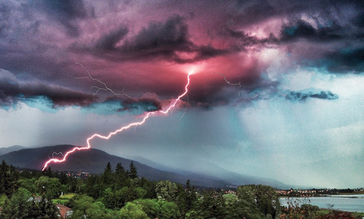
A thunderstorm that ripped through the Kamloops Fire Centre Sunday night produced more than 1,200 lightning strikes.
Kelsey Winter, fire information officer, said, as of yesterday, the Kamloops Fire Centre confirmed 50 new fires. Crews were dispatched Monday to check on three in the Salmon Arm Zone – Wap Creek, Grassy Lake and Mabel Lake.
Meteorologist Matt MacDonald says Environment Canada maps indicate that between 9 p.m. and 1 a.m. Sunday, July 19, there were 105 lightning strikes in an area from Chase to Revelstoke, and from the southern end of Mabel Lake to Adams Lake.
While thunderstorms were forecast in the Shuswap for last night and tonight, MacDonald says Friday into Saturday looks like the best chance for rain this week.
“We’re seeing a change,” he said, noting Sunday’s 33C was one degree shy of a record, but that high temperatures were to begin dropping by five degrees by Tuesday. “There’s a big trough of low pressure that will keep temperatures cooler; the humidity will go up and there’s a chance of showers throughout the week.”
MacDonald pointed out that, as of July 20, Salmon Arm had recorded only 1.2 mm of rain when the normal for July is 46 mm.
“We still have 11 days, but we’ve only seen two per cent of normal rainfall,” he said. “It’s going to be showery during the week with the little disturbance rolling through and the weekend looks unsettled. After next Monday, temperatures are expected to rise again with another stretch of dry weather.”