The City of Salmon Arm is all for updated mapping to detail how susceptible city areas are to flooding.
City staff asked council on Jan. 23 if it would authorize the city’s participation in a Floodplain Mapping Initiative Project being funded by the federal and provincial governments and managed by the Fraser Basin Council.
Council unanimously approved the move.
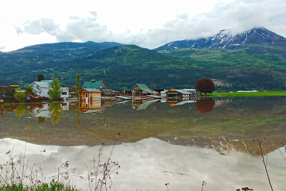
Rob Niewenhuizen, the city’s director of engineering and public works, noted the one-in-200-year flood levels have been mapped out in the Salmon River Valley and areas around Shuswap Lake.
“Obviously they’re very beneficial to planning and engineering,” he said, adding the last time such maps for the Salmon Arm area were produced was in the late 1980s – 1987 and 1989.
The new initiative aims to develop high quality, standardized, consistent floodplain mapping for higher-risk communities.
“Floodplain maps support municipal decision making by demonstrating the risks to both existing and proposed developments and infrastructure and, in the process, help foster resilient community growth and emergency planning. To be effective, however, floodplain maps should be updated regularly to account for many factors, including changes in development, the environment and climate,” said staff’s report to council.
Read more: Floodplain mapping urged
Coun. Sylvia Lindgren voiced her enthusiasm for the project, saying the city’s Environmental Advisory Committee has been advocating for updated floodplain mapping since she became chair four years ago.
“They’re going to be very happy,” she remarked.
Coun. Tim Lavery was also enthusiastic.
“It’s absolutely great news…,” he said, adding it has become pretty apparent updated floodplain mapping is needed all over the province including Salmon Arm. “I’m glad to see it and I look forward to the results.”
The plan is to have all the floodplain maps in the region done by March 31, 2024, subject to funding from the federal flood hazard identification mapping program.
The high-water mark and one-in-200-year flood levels played an important and controversial role in the size of the Smartcentres development in Salmon Arm which houses Walmart.
Read more: Report vindicates WA:TER
A citizens’ group repeatedly asserted that the development, initially to spread over 55 acres, would be built over channels historically taken by the Salmon River, and should be scaled back. The group made Freedom of Information requests to access the company’s Qualified Environmental Professional (QEP) report and pointed out flaws in its data and conclusions pertaining to issues such as the high water mark and one-in-200-year flood levels.
According to a 2014 B.C. ombudsperson’s report on the Riparian Areas Regulation, which doesn’t name Salmon Arm but recounts its history: “The citizens contacted the ministry with their concerns and, as a result, the ministry, for the first time in the history of the RAR, hired an outside consultant to review the QEP’s work. The ministry ultimately required the QEP to submit a fifth assessment report. This resulted in a reduction of the area available for the development from more than 24 hectares to approximately 6.5 hectares.”
Read more: Neskonlith Band demands flood assessment
Read more: Video: Peak levels for Salmon River downgraded
martha.wickett@saobserver.net
Like us on Facebook and follow us on Twitter and subscribe to our daily newsletter.