“Sobering” is one word used to describe a recent study of Bastion Mountain and the serious landslides that have taken place there in recent years.
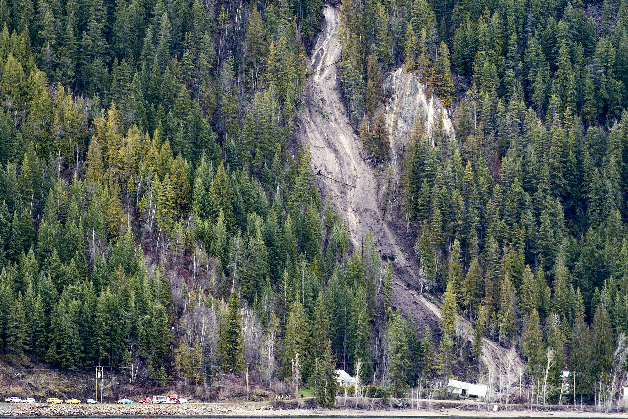
Subsequent to the 2014 McIntyre Creek slide, and the 2017 slides at Handy Brook and Robinson Creek which destroyed homes and claimed one man’s life, a geomorphic assessment of Bastion Mountain was initiated by the Columbia Shuswap Regional District to determine future landslide risk. The study was funded by the Union of BC Municipalities.
Recently completed by Kerr Wood Leidal Consulting Engineers, with assistance from Westrek, the assessment results, detailed in a report, shows various kinds of landslides have occurred. For example, the Handy Brook slide, which destroyed two homes but miraculously spared the occupants, was an open slope failure, while the Robinson Creek slide, just a few days later, was a debris flow.
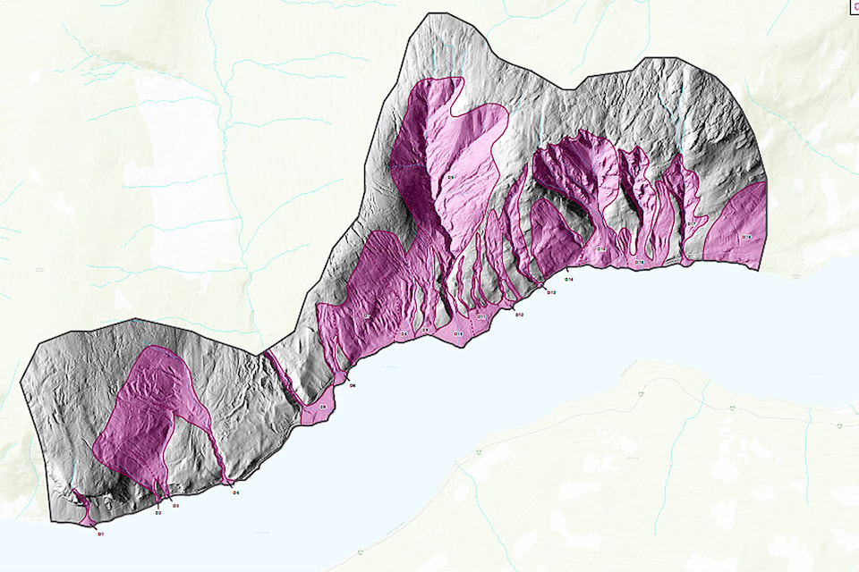
The 13 creeks which run down Bastion Mountain were a major focus of the study.
Read More: CSRD to map Bastion Mountain to better understand landslide risk
Read More: Sunnybrae slide area concerning
The report, which draws its conclusions from Lidar mapping, helicopter flyovers and fieldwork in the areas affected by slides, makes a number of recommendations. Among them, that an acceptable level of risk be determined for new developments in the studied area, and a tolerable level of risk for existing developments. Working from the tolerable risk level, the report recommends conducting detailed landslide risk assessments for existing and proposed developments to see if mitigation work should be done.
Simon Gautschi from Westrek, who presented the study results with Dwayne Meredith from Kerr Wood Leidal to the CSRD board, said most local governments have not yet developed an acceptable landslide risk level to inform decisions on development.
According to the report, the culverts along Sunnybrae-Canoe Point Road are significantly undersized to pass clear water floods, except for the recently-replaced culvert at Robinson Creek. They are susceptible to blockage from sedimentation and debris floods.
Read More: Theory emerges on landslide cause
Read More: CSRD pursuing flood-risk maps of Shuswap
Further assessment of the entire Reinecker Creek watershed for its debris flood potential is also recommended. Meredith said the large watershed was excluded from this project to keep costs in check.
The creation of a landslide database which would serve as a collection point for information on futures slides, and the updating of landslide hazard maps is also recommended.
“Over time you will see where the hot spots are, where you have to focus your attention and other areas that are less problematic based on the historic record, so that’s a very good tool to keep track of things,” Gautschi said.
Director Paul Demenok, who represents the residents living in the studied area described its results as “sobering” and noted it would have implications for hundreds, if not thousands of people.
“We’re taking the report very seriously and working towards implementing those processes that are necessary,” said Derek Sutherland, the CSRD’s protective services team leader.
@SalmonArm
jim.elliot@saobserver.net
Like us on Facebook and follow us on Twitter